Arizona to Nampa, Idaho Cross Country Trip 2007
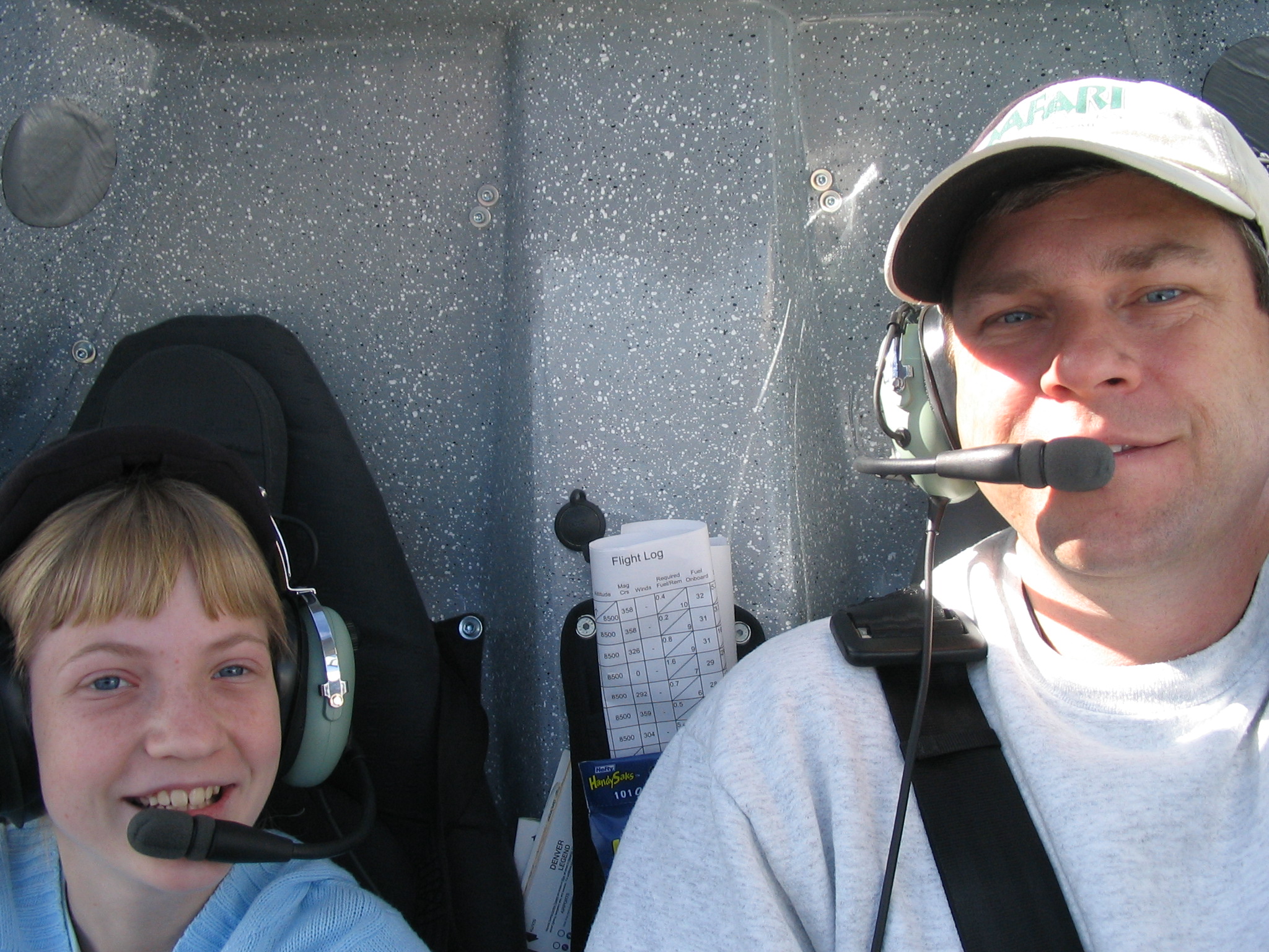
After the demise of Blonde Streak I thought I may never get the opportunity to do another cross-country trip with another of my daughters, but that wasn't the case at all! A good friend of mine, Harold Thomas, spends his winters in Arizona and summers in Boise, Idaho. In the past few years Harold has become a Sport Pilot, having let his Medical expire toward his Private Pilot's certificate. He hasn't just become a Sport Pilot, but a Light Sport aircraft owner and seller. Harold flies the Flight Design CTSW, the most popular in sale of the new Light Sport Planes. He graciously lets me fly his plane whenever I get the urge to fly and I've happily taken his offer up a number of times. In fact I have about 30 hours in the CTSW since November of 2006.
In early April of 2007 Harold purchased a used CTSW from a gentleman in Arizona and needed someone to ferry it to Idaho. I volunteered as it seemed like a great opportunity to bring my middle daughter along for some time together. We planned to leave Chandler (KCHD) Thursday morning April 27th and make a two day trip of it. Day 1 would consist of some sightseeing over the Grand Canyon, Lake Powell, Monument Valley and Bryce Canyon with a layover in Cedar City, UT. Day 2 would be a flight over the Great Salt Lake, Snake River Canyon, Twin Falls and into Nampa, Idaho. We also planned to do some sightseeing on Day 3 in the backcountry of Idaho.
The week prior to the flight was spent replacing the airworthiness certificate in the CTSW which had somehow gotten lost in the transfer of ownership. The great folks at the Reno FSDO went above and beyond my expectations in getting a new certificate and operating limitations printed up and sent Next Day FedEx to me. I took a couple of flights in N135CT to get familiar with it and determined I would need a new GPS antenna before the flight. The one in the plane kept losing the satellite signals shortly after takeoff and a Garmin 396 was all the Nav equipment in the plane (other than the compass!). I wasn't quite ready to fly using dead reckoning the whole way so just in case I couldn't I bought a Sporty's handheld SP-200 NAV/COM Transceiver to replace my old one that had burned up in N309BD. As it turned out the GPS just needed a new antenna (an active antenna vs the passive one installed previously) so we had good GPS navigation the whole way and I never used the SP-200.
April 27, 2007 - Day 1:
 My middle daughter Kara was excited to get out of school for a
couple of days no matter what the reason, so she was looking forward to the trip
with her Daddy. We said our goodbyes to her sisters and Mommy and headed to the
airport around 7am. The weather was forecasted to be nice all the way to Cedar
City so we loaded up the plane with fuel and did a thorough preflight
inspection. We were ready to go by 7:45 and started up the plane for our first
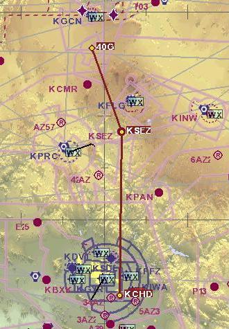
leg; Chandler (KCHD) to Valle (40G)
airport in Northern Arizona. This leg would take us north over the Phoenix metro
area, over Sedona (KSEZ)
airport and west of Flagstaff.
My middle daughter Kara was excited to get out of school for a
couple of days no matter what the reason, so she was looking forward to the trip
with her Daddy. We said our goodbyes to her sisters and Mommy and headed to the
airport around 7am. The weather was forecasted to be nice all the way to Cedar
City so we loaded up the plane with fuel and did a thorough preflight
inspection. We were ready to go by 7:45 and started up the plane for our first
leg; Chandler (KCHD) to Valle (40G)
airport in Northern Arizona. This leg would take us north over the Phoenix metro
area, over Sedona (KSEZ)
airport and west of Flagstaff.
The CTSW cruises around 112kts so this 146nm leg would take approximately 1-1/2 hours. We departed Chandler's (KCHD) runway 4L at 8:10am and climbed to 2500 feet to stay below the Phoenix Class B until north of the city. At that point we did a stepped climb to 8500 feet for the remainder of the leg.
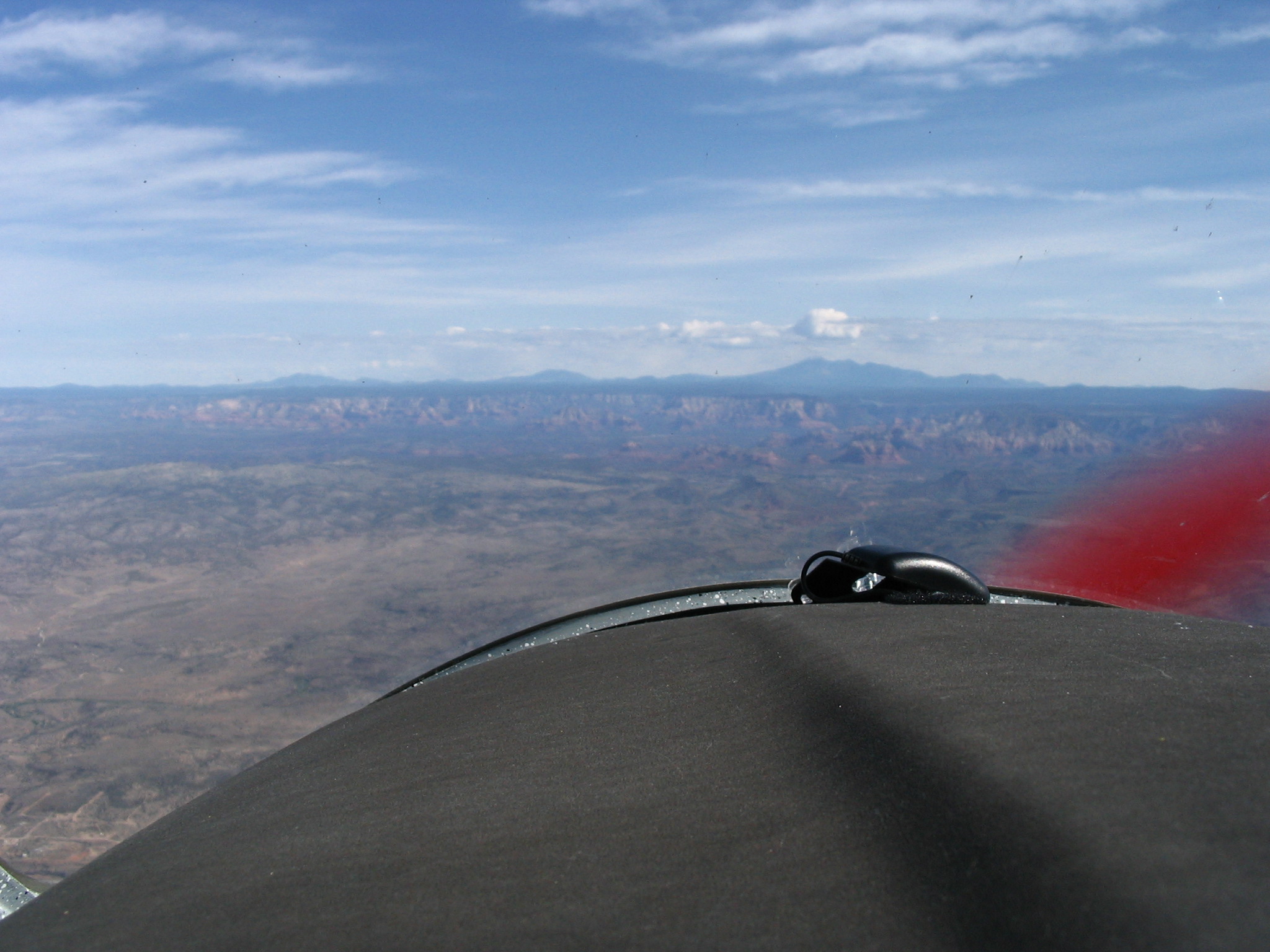
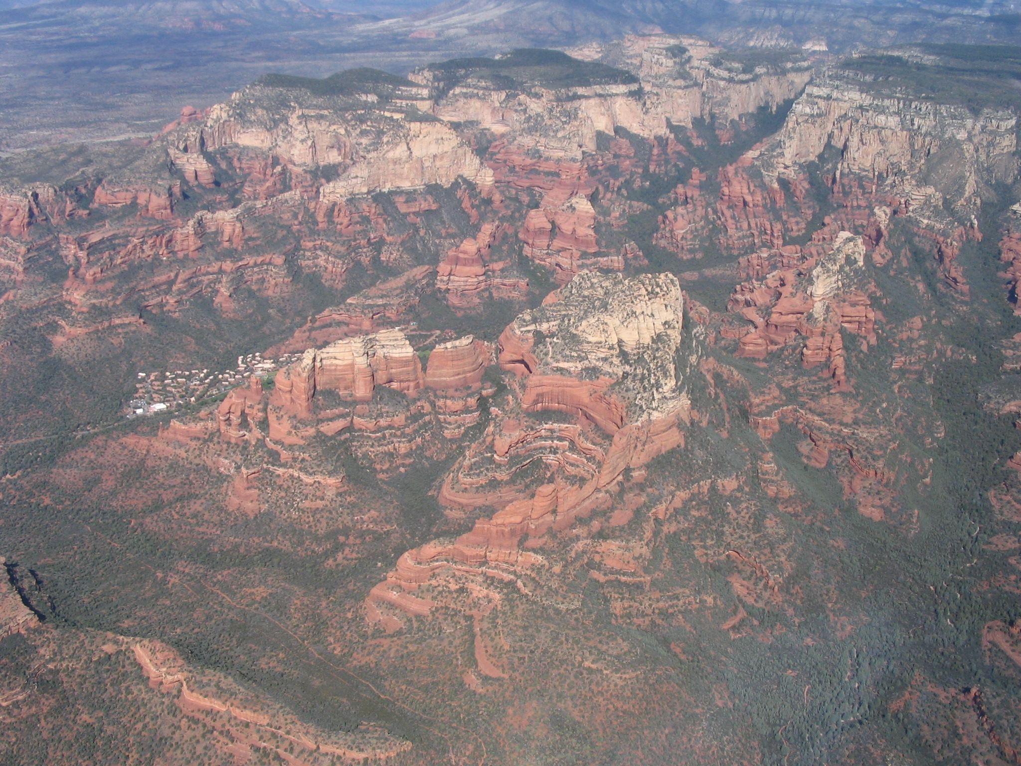
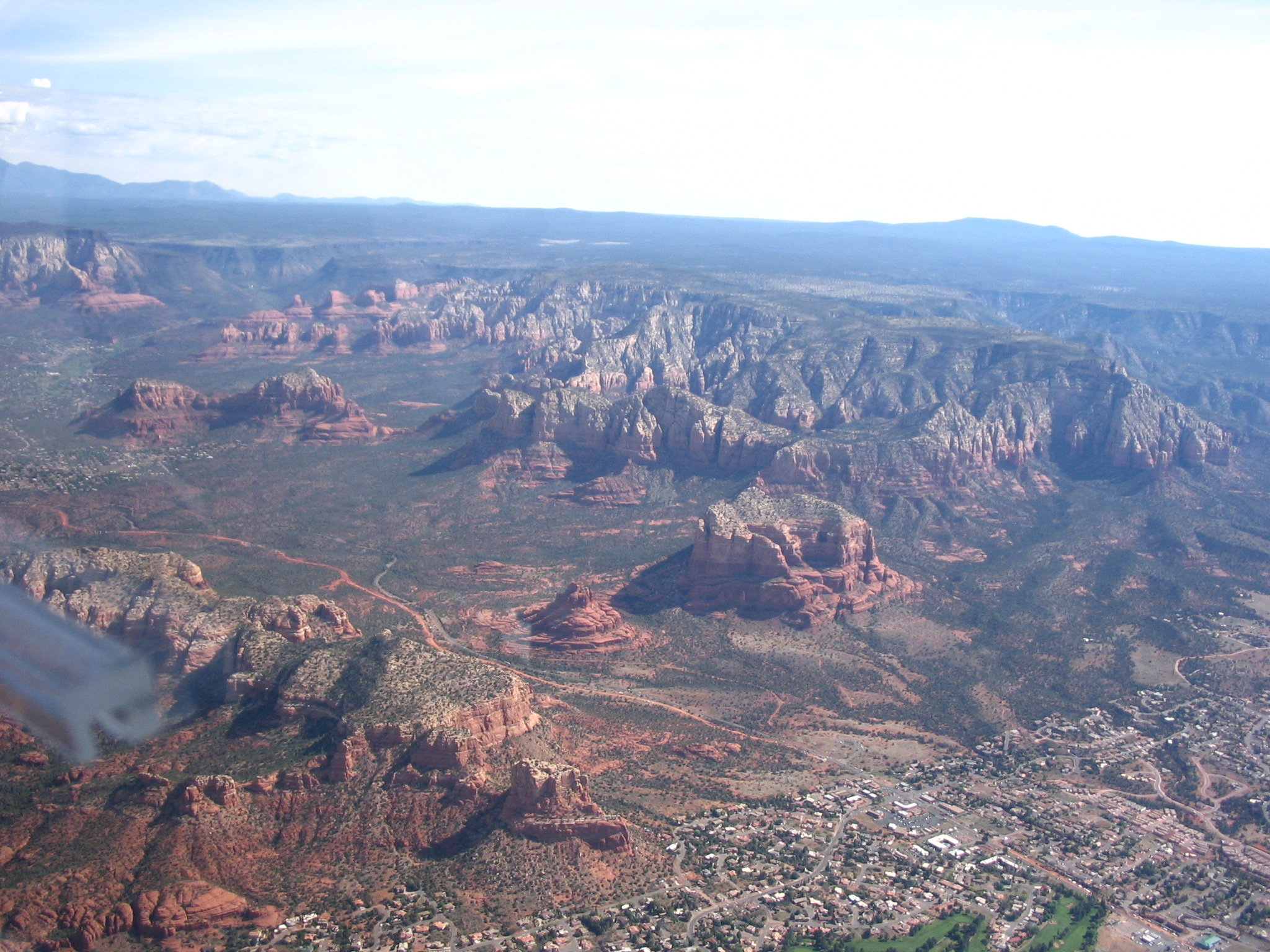
We crossed Sedona (KSEZ) exactly one hour later. This is when it occurred to me how slow this plane is compared to the Cozy - I used to fly that trip to Sedona in less than 40 minutes in the Cozy and here we were crossing the town in one hour! We sure weren't going to miss any scenery at this speed! We made a slight turn to the northwest heading for Valle (40G), a small airport south of the Grand Canyon. I wasn't sure how quickly we'd be able to get in and out of the Grand Canyon Airport (KGCN) so avoided it for the sake of time and convenience. About 25 minutes later I had the Valle airport in site and landed uneventfully at 9:40am. The winds weren't helping us at all as far as ground speed goes. This first leg of our trip took 1-1/2 hours and covered 146 nautical miles.
We parked the CTSW and walked into the lounge which doubled as a vintage car museum and used the restrooms, called my wife to let her know where we were and got back in the plane. We were airborne again at 10:15am.
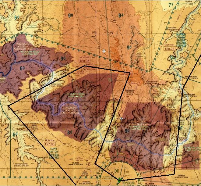
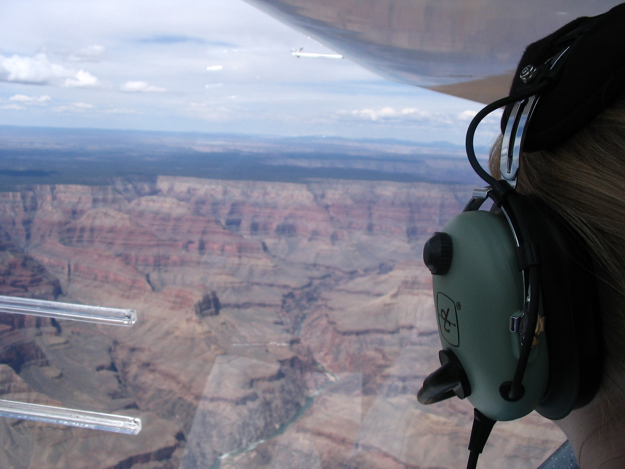
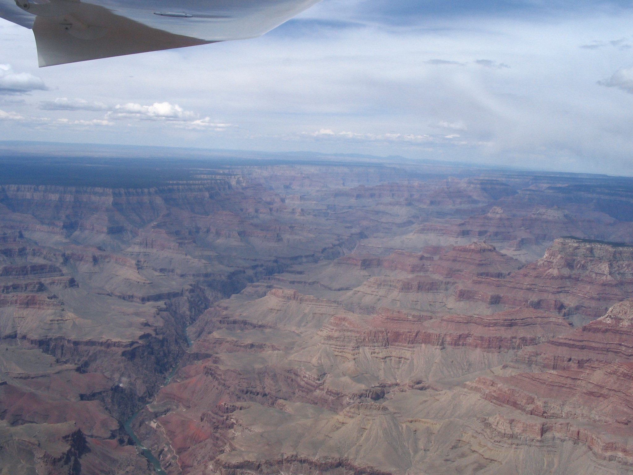
Our next leg of the day be to fly over the Grand Canyon for a different perspective of this magnificent wonder of nature. Many people believe that flying over the Grand Canyon is prohibited, but that is far from the truth. There is a special VFR Aeronautical Chart of the Grand Canyon which details the prohibited sectors of the canyon, but also the special corridors that allow VFR flight through some of the most scenic areas over the canyon. Granted, you can't fly into the canyon, but you can get as close as 2000 feet above it in some areas and the corridors allow you to fly directly over as low as about 4000 feet above the rim. The precise altitudes and locations of the corridors are contained on the Grand Canyon VFR Aeronautical Chart and the procedures are detailed in 14 CFR Part 93 and SFAR 50-2.
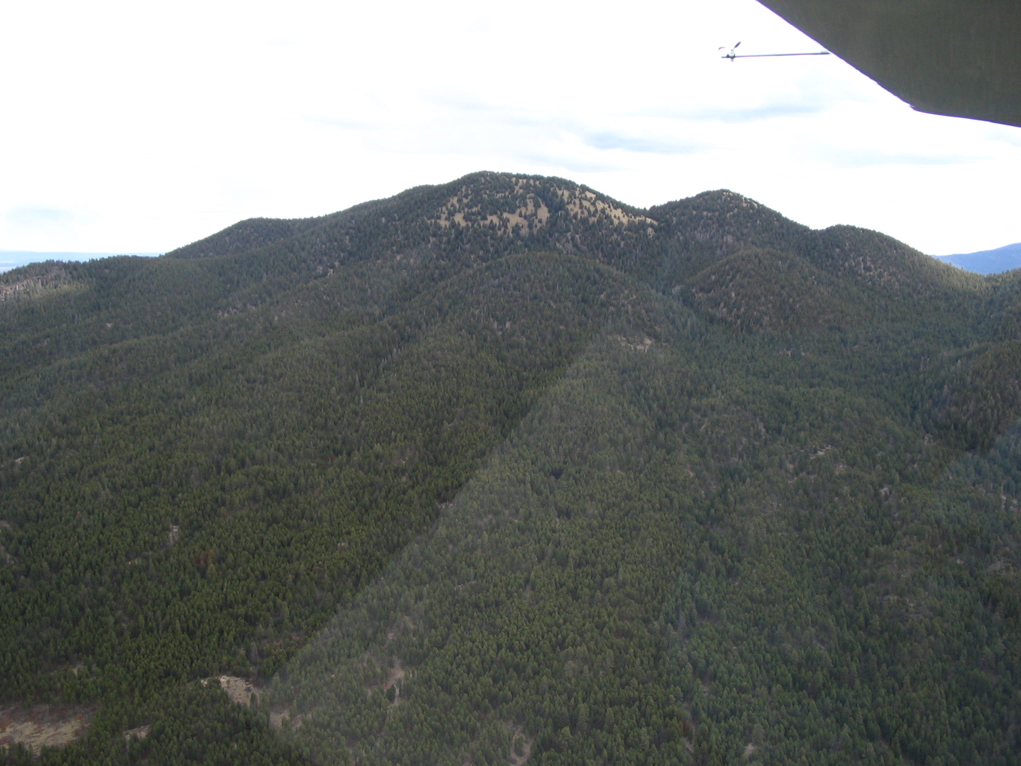
The rim of the Canyon ranges in altitude from approximately 6000 feet to over 7000 feet. Our planned route would take us from the Valle airport to directly over the Supai Village. We had to be above 10,000 feet upon entering the Supai Sector (west of Grand Canyon Village, the main visitor's center for the Grand Canyon) so we climbed steadily out of the 6000 foot elevation Valle airport toward the northwest. We continued our climb to 11,500 feet as this is the minimum northbound altitude for the Fossil Canyon Corridor we would be taking over the Canyon after we arrived over Supai Village. I tried to locate Supai Falls but didn't plan well enough ahead of time to know exactly where to look. From 7000 feet up in the air it may not have been recognizable anyway - whatever the case I couldn't see it! We made a 90 degree turn to the right over the village and headed out over the Canyon. We could clearly see the rapids of the Colorado River below us as it wound its way through the Canyon. The Fossil Canyon Corridor is approximately 4 miles wide so I had to be precise about where I was flying in order not to encroach on the Flight Free Zone on either side of the Corridor.


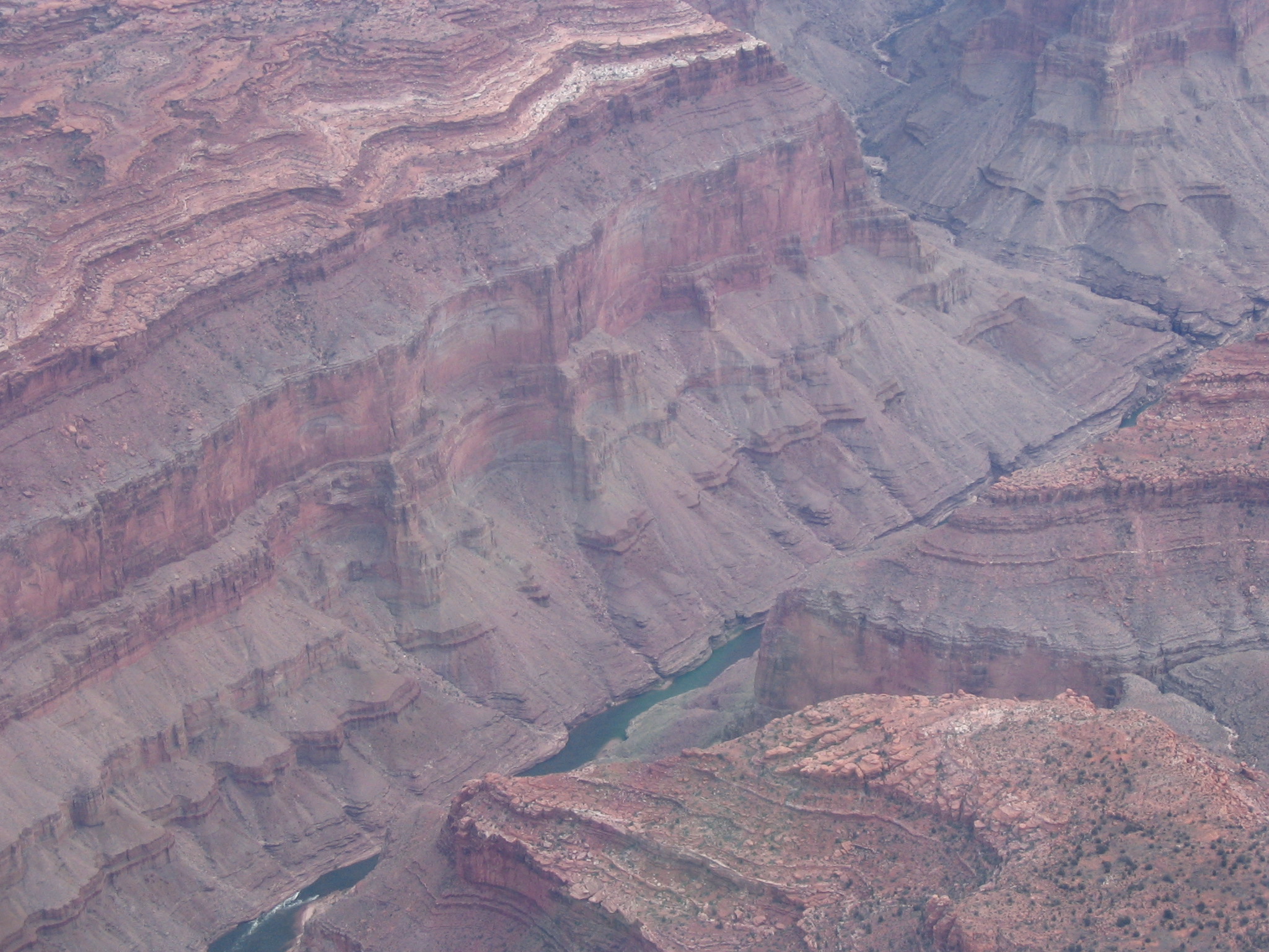
As we approached the northern boundary of the Corridor a large snow cloud was to our right - directly over where our flight path would take us. It was slowly moving to the south so we did a few 360 degree turns over the North Rim waiting for it to pass. After about 20 minutes we were able to have a clear path to the Dragon Corridor so we proceeded on course to the south. In this direction the minimum altitude is 10,500 feet so we descended a bit and flew through the Corridor directly over the Tower of Ra, across the river and just to the west end of the West Loop Drive. This is as far as you go on the ground tour, so we had some really good seats! We then turned to the southeast to fly directly over the Grand Canyon Airport then made another turn to head east to the southern end of the Zuni Point Corridor.
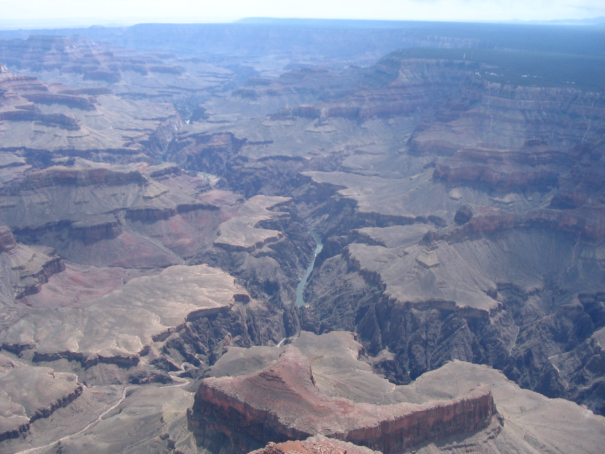

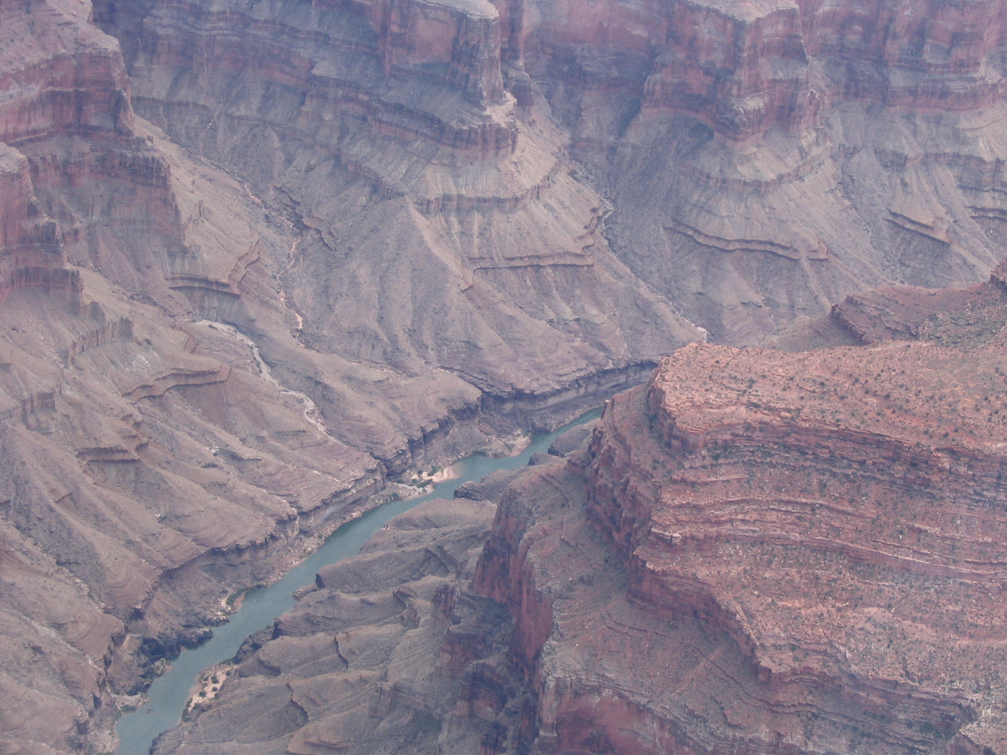
This is just west of the Desert View lookout on the East Loop Drive. We again climbed to 11,500 feet for our northbound trip through this Corridor toward Temple Butte and the confluence of the Little Colorado River with the Colorado River. The Little Colorado is a light blue color from the air and contrasts with the green waters of the Colorado. We proceeded north until we crossed the boundary of the Supai Sector into the Marble Canyon Sector.


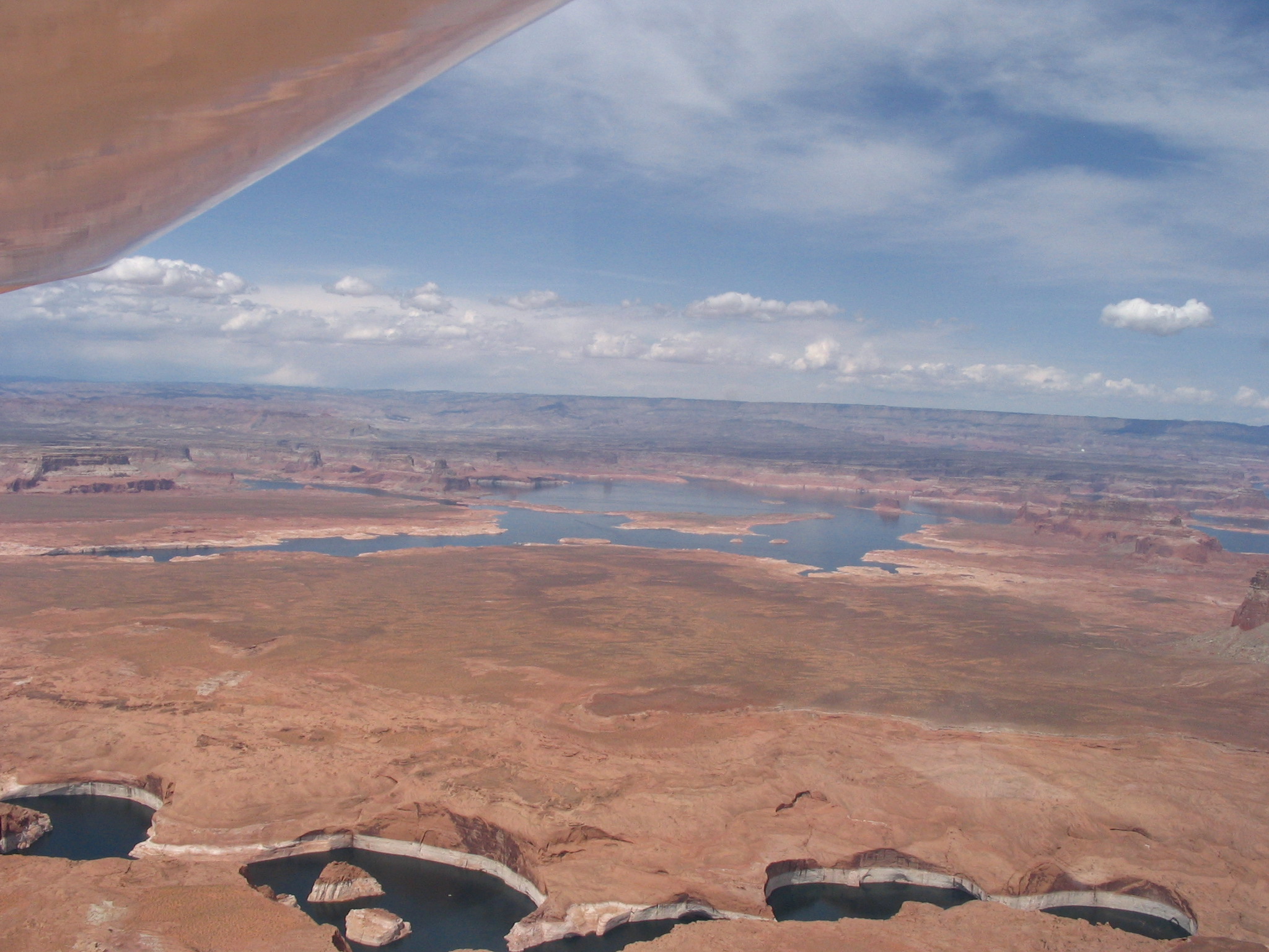
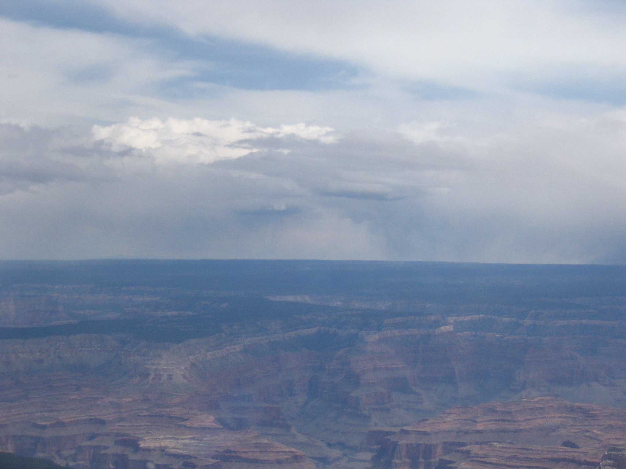
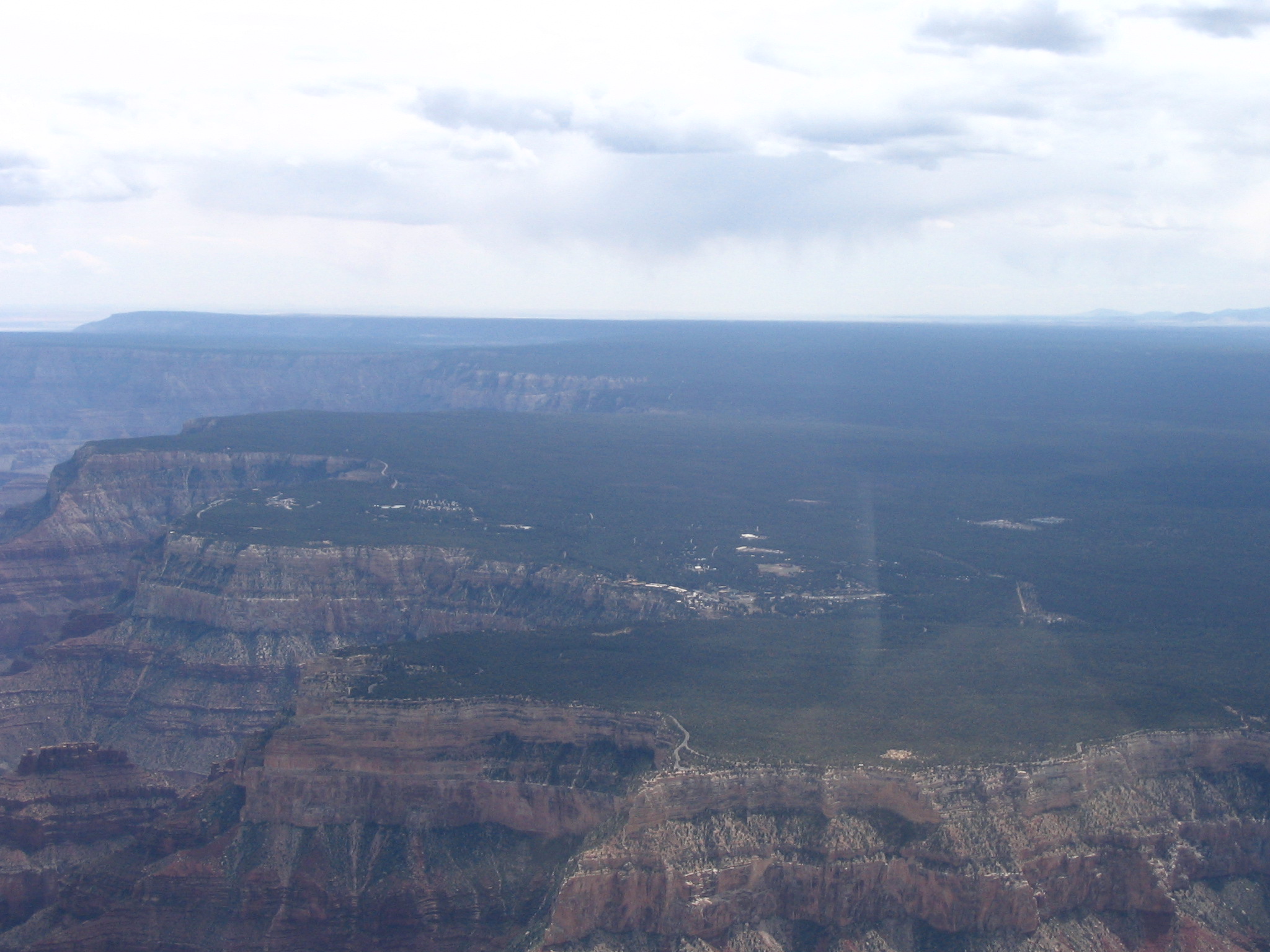
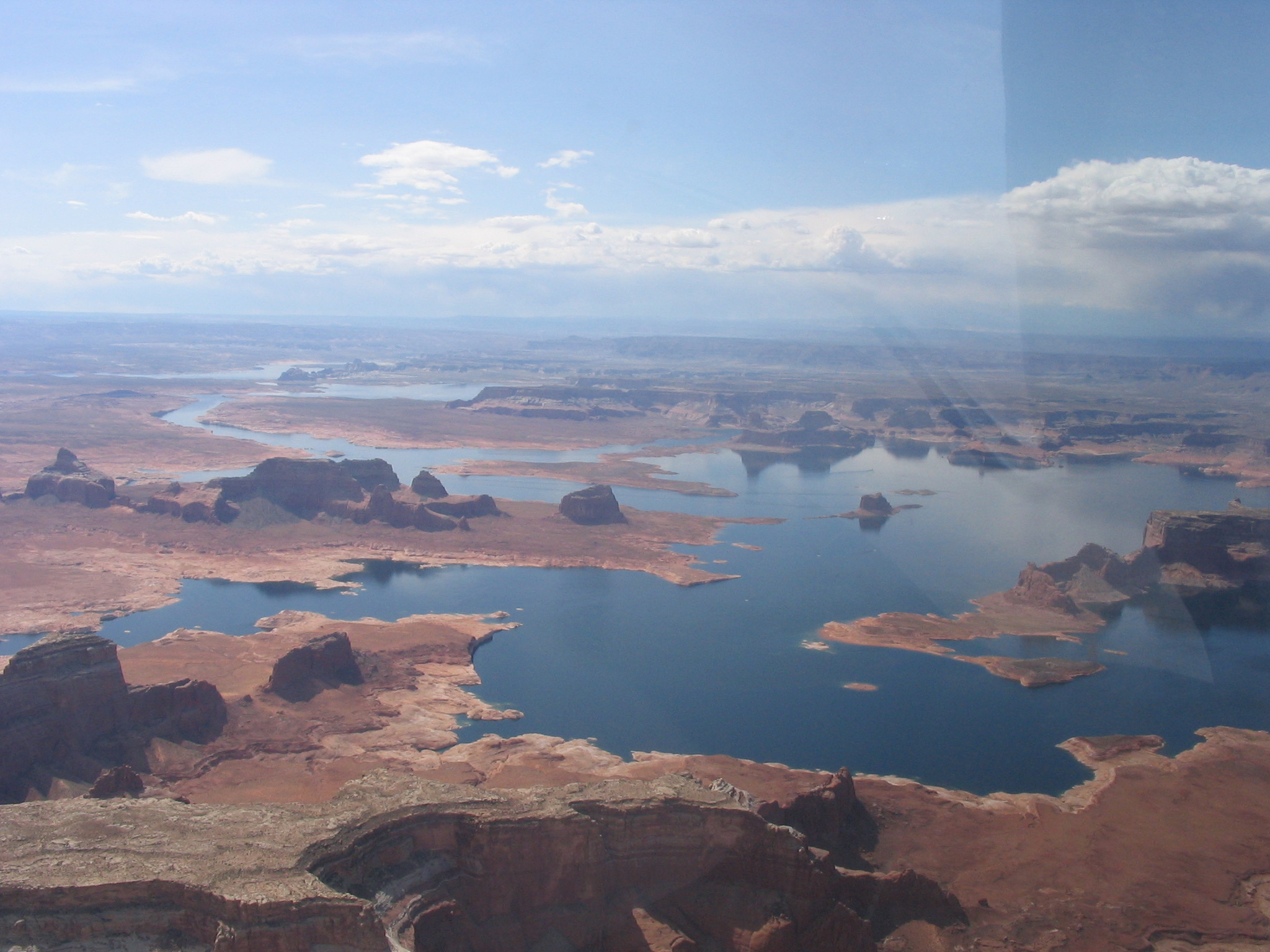
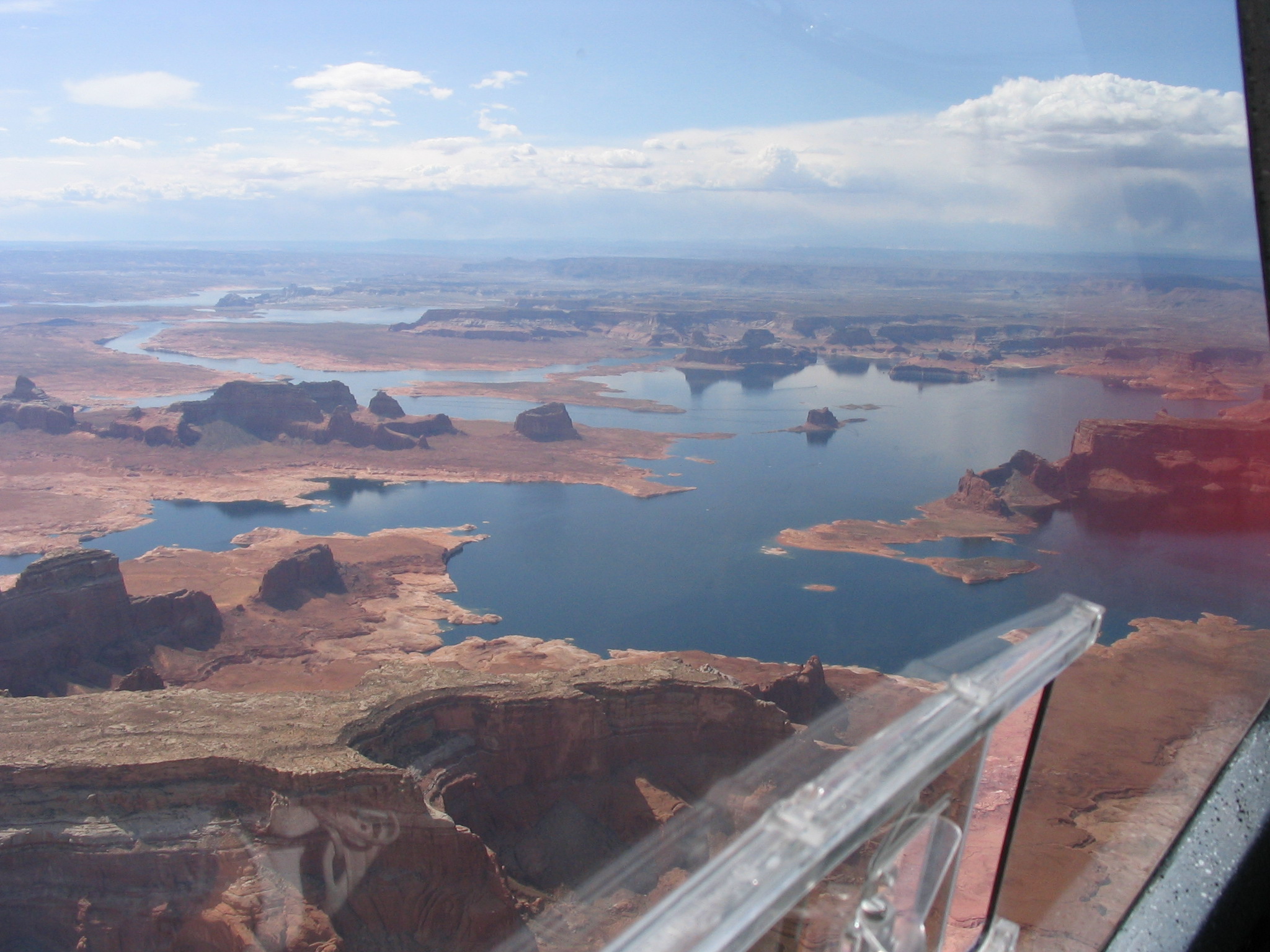
We were able to descend to 9500 feet as we flew along the Canyon toward the Glenn Canyon Dam and Lake Powell. It was approaching noon so we landed in Page, AZ (KPGA), AZ for lunch. We flew in excess of 175nm in exactly 2 hours, landing in Page at 12:15pm. We topped off the tanks with 18 gallons of fuel and then were given the crew car to run into town and grab a bite to eat at the local KFC. It was good to get out and stretch for a while but we could see some accumulation of clouds to our north and figured we'd better head back to the airport to begin our final leg of the day.
![]()

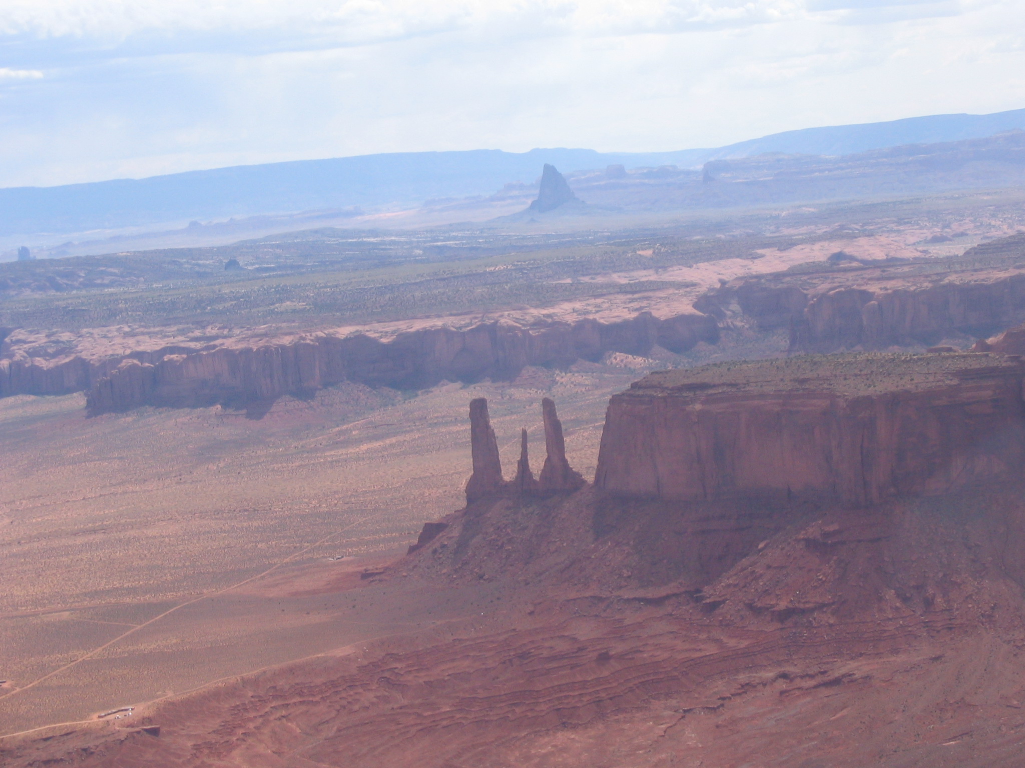
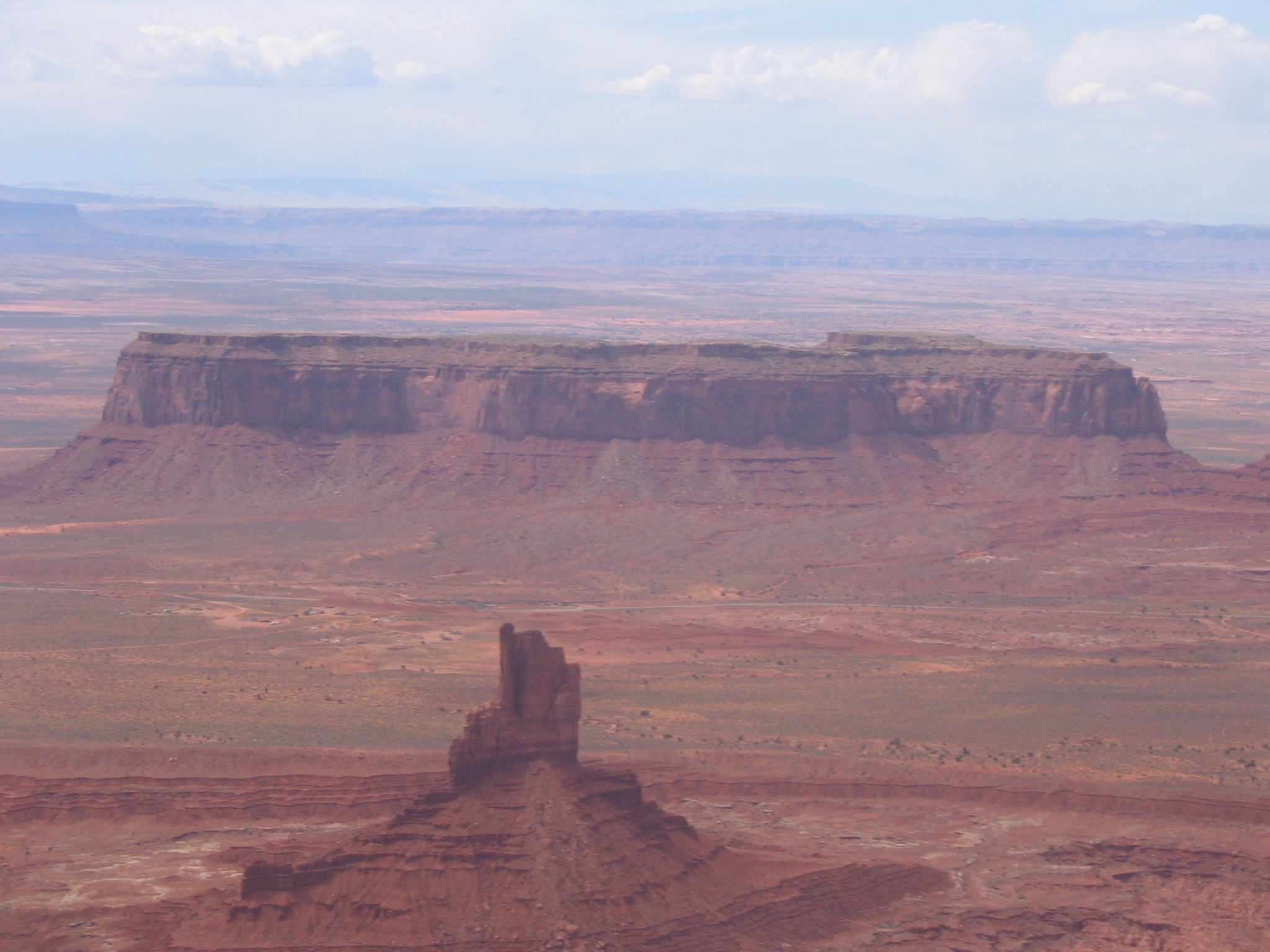
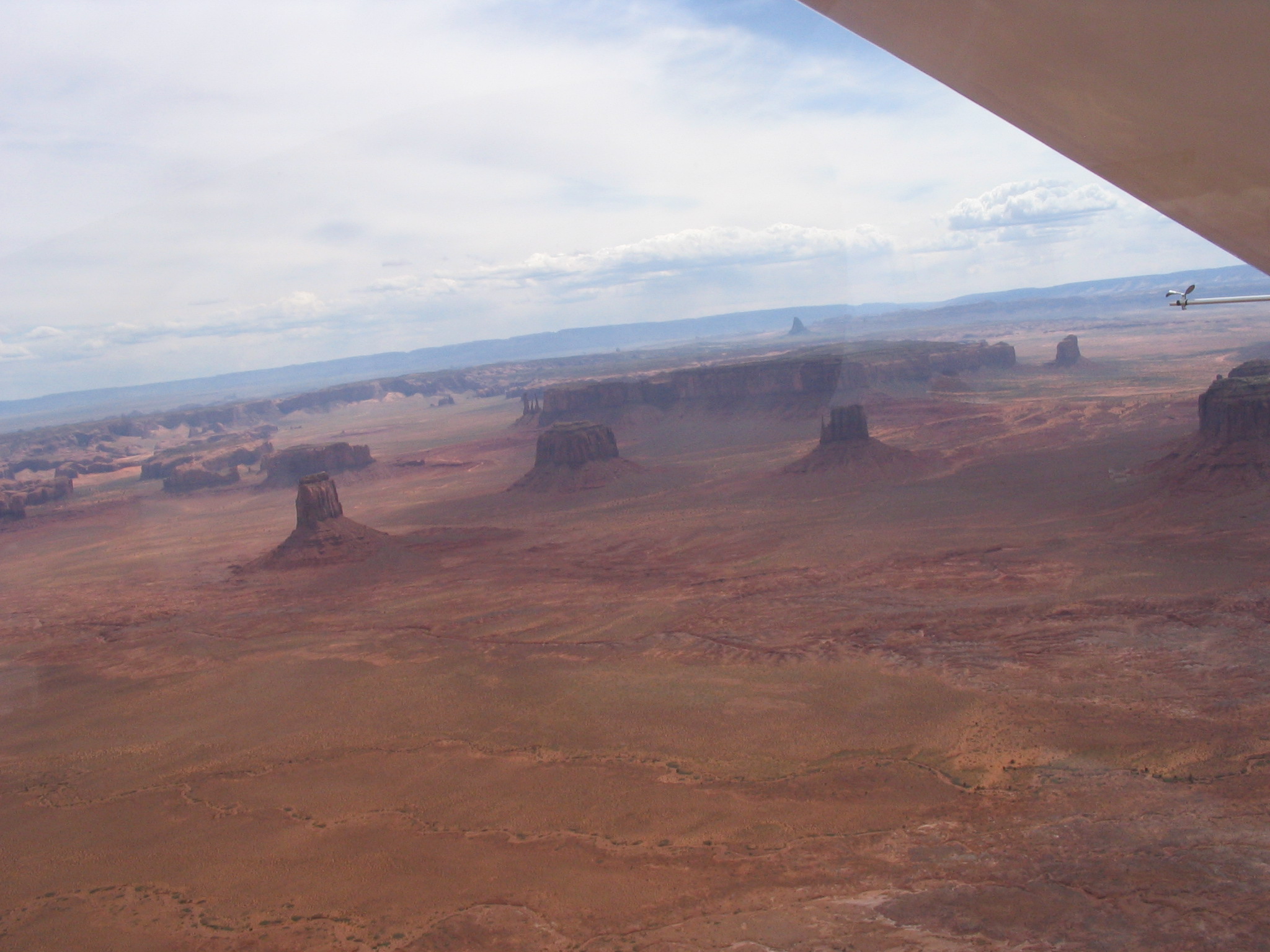
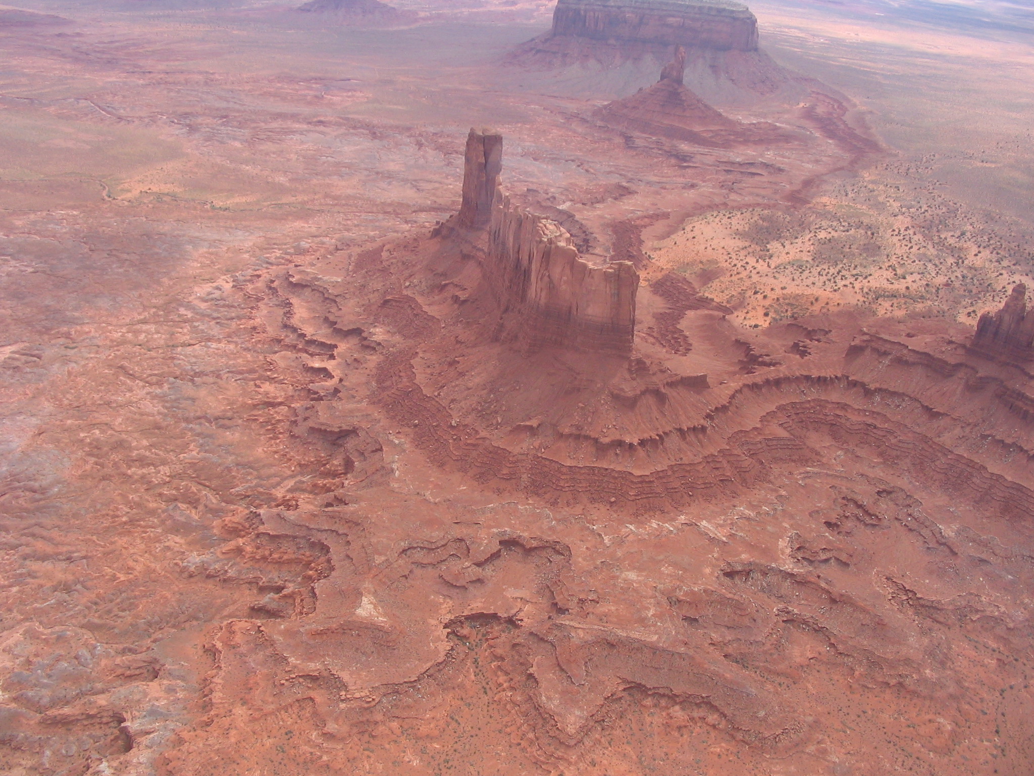
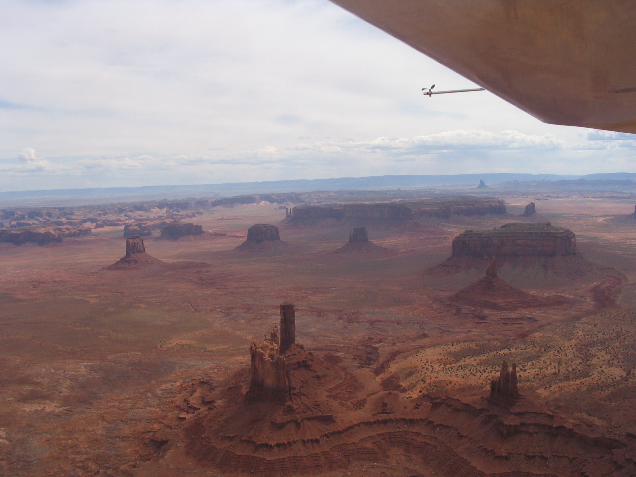
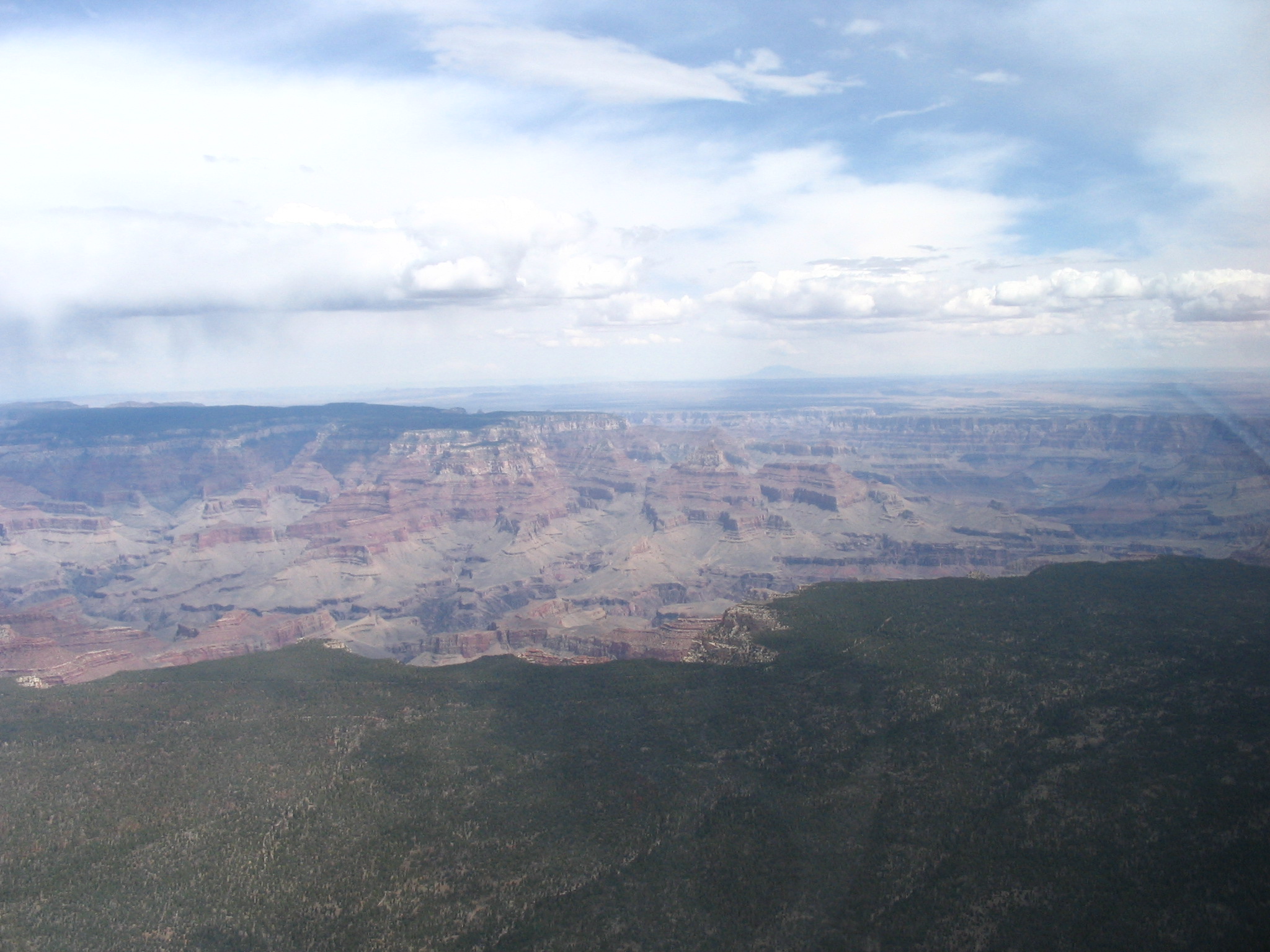
We taxied back out to runway 33 and took off at 1:30pm heading out over Lake Powell and then turning east toward Monument Valley. This diversion would take us about 30 minutes but was well worth it. The view of Monument Valley from the air is breathtaking! We flew a large circle around the monuments taking in the sights and shooting a few pictures, then head back toward Lake Powell to see of we could spot Rainbow Bridge. Well, having never seen it from the ground may have hindered us a bit because we never did see it.
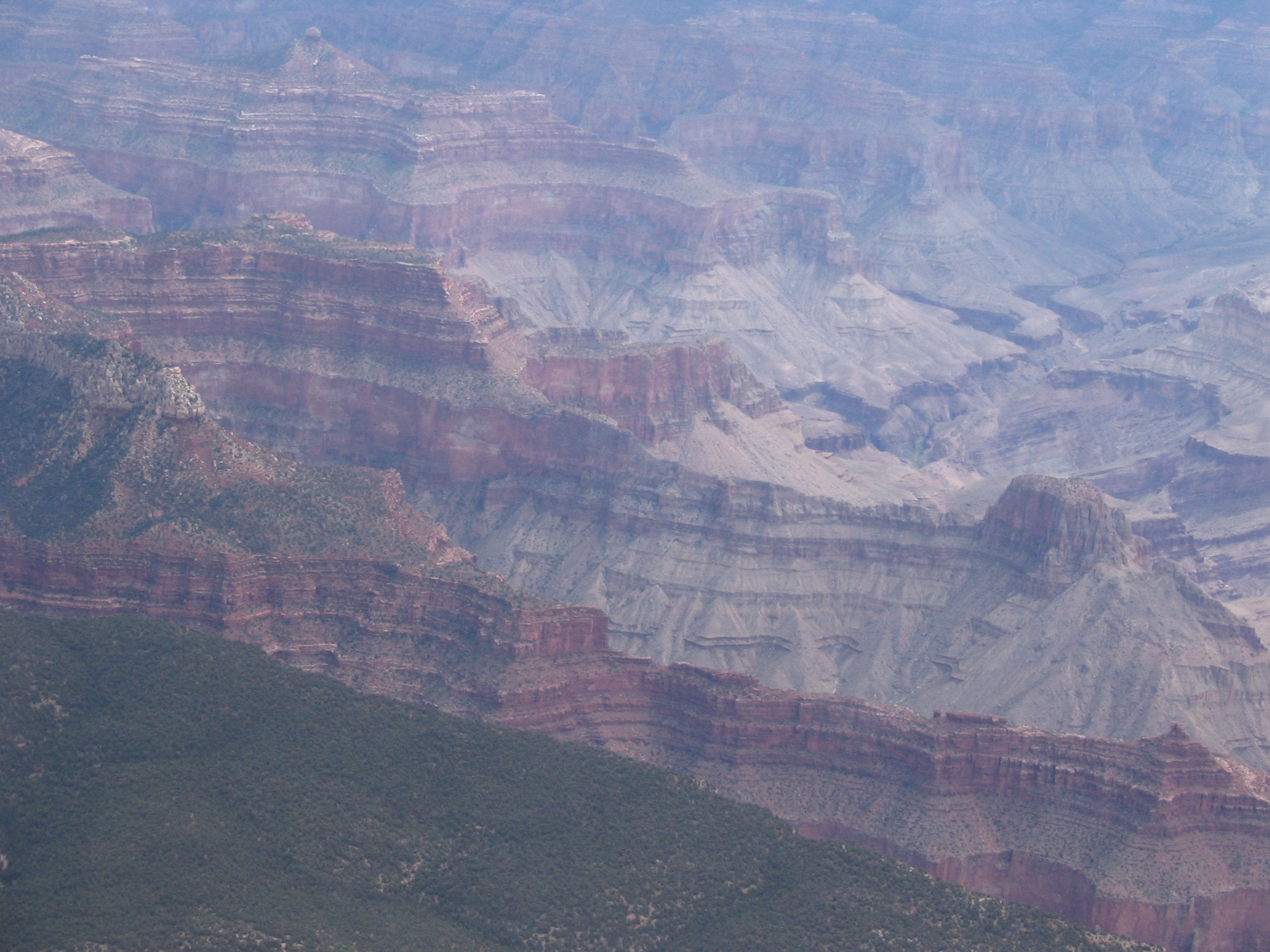
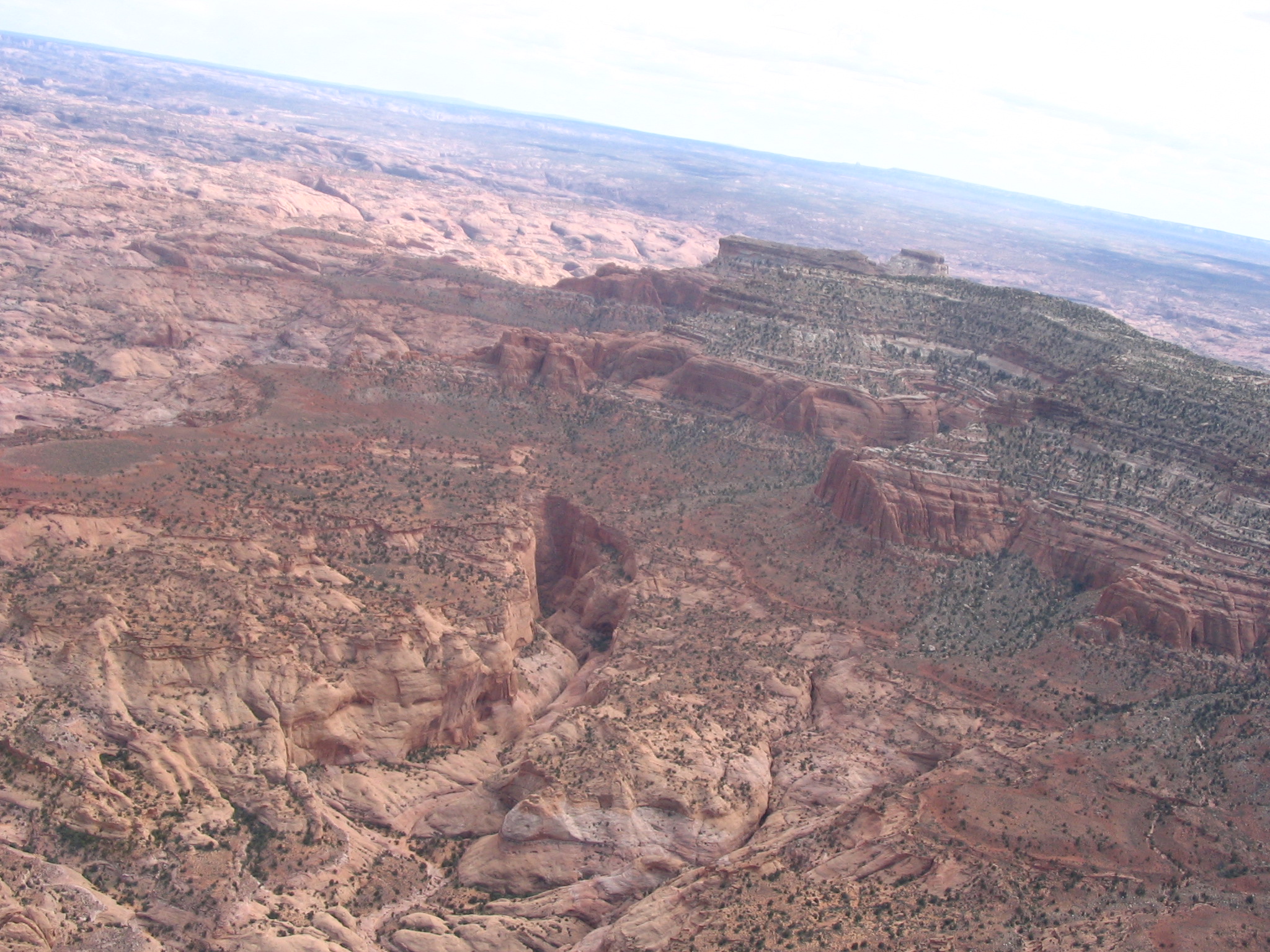
The clouds were starting to get darker toward our destination in the northwest, so we didn't spend a lot of time looking further. We turned heading toward the Bryce Canyon VOR which would take us directly over Bryce Canyon National Park. This would be our last tourist spot for the day and was just a few miles out of the way from our overnight destination in Cedar City, Utah. As we continued toward Bryce Canyon it became obvious the weather wasn't going to cooperate. Directly ahead were large dark clouds with showers and mountain obscurity. We tracked to the southern end of the storms and just caught the southern end of the National Park area. The scenery was enough to give us a sense for what we were missing, but it would have been nice to see the rest of the Canyon.
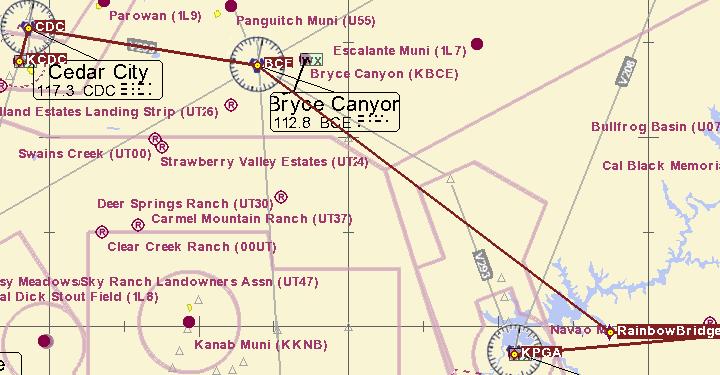

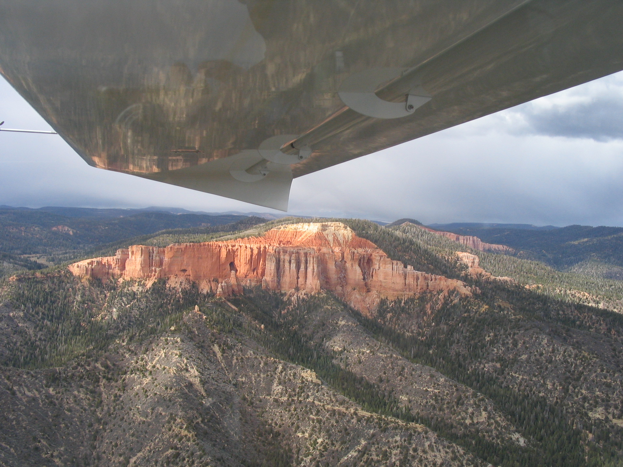
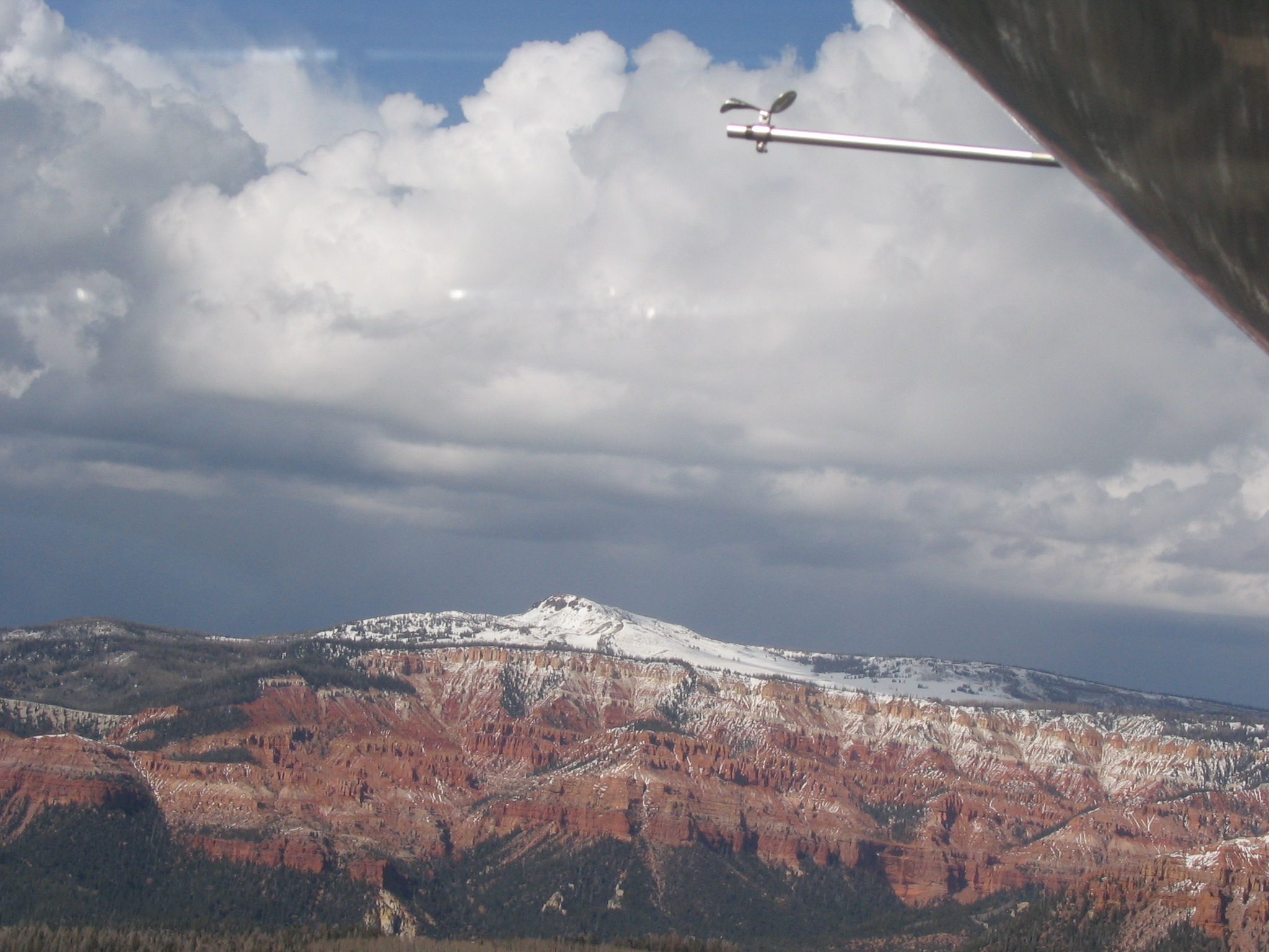
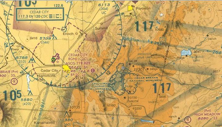
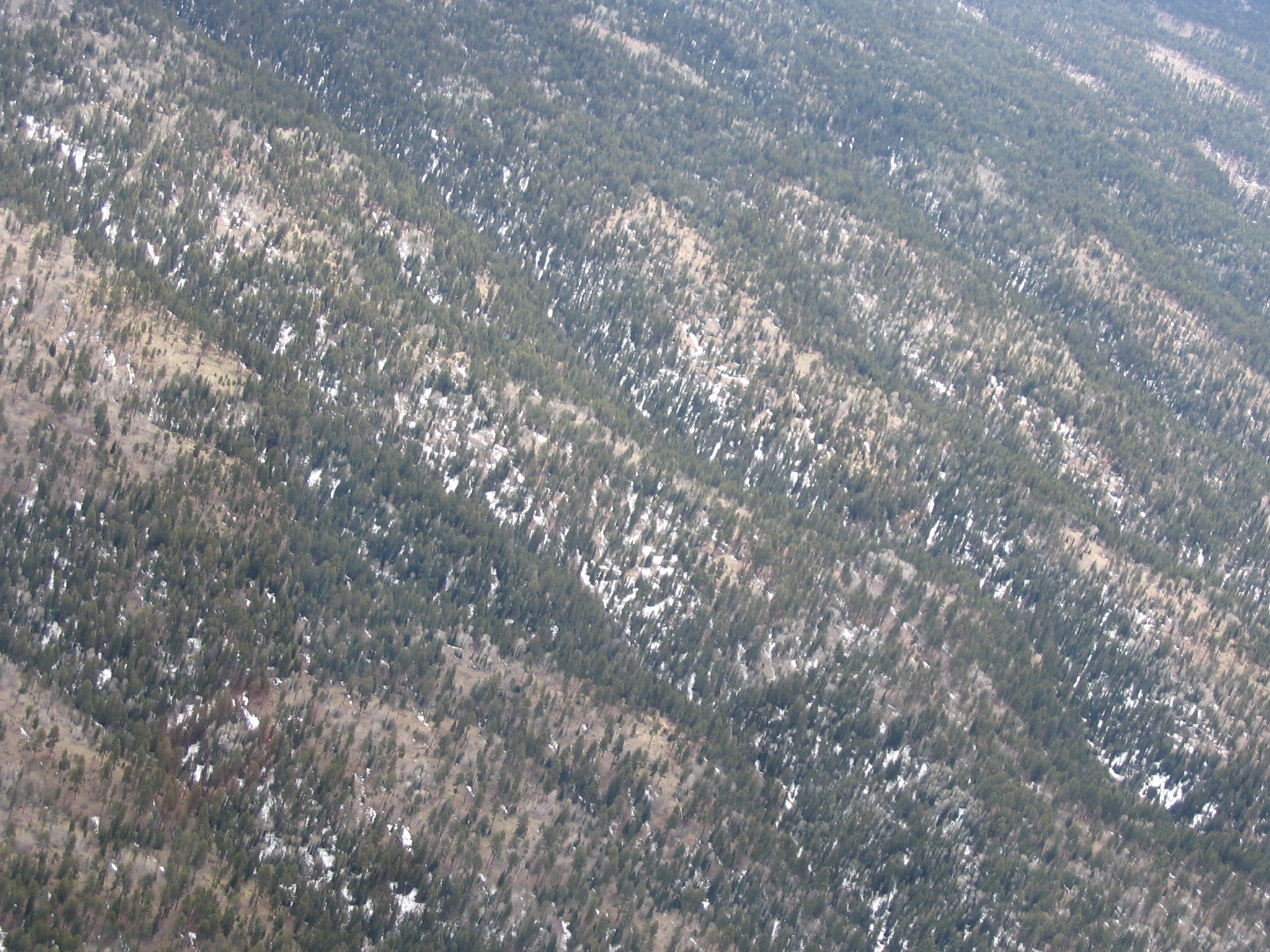
Cedar City lies to the west of some rather large mountains, most are over 10,000 feet in elevation. Brian Head Ski Area is right in the midst of these peaks. We climbed to 10,500 feet and made our way through some snow covered valleys and eventually found ourselves (well, we weren't lost - just a bit off our planned course) popping out of the mountains and looking down into the valley below us. Cedar City Regional (KCDC) is at an elevation of 5622 feet, so we had descended fairly rapidly as we approached the airport. The skies were beautiful and clear on this side of the mountains and in now time we were lined up for final on runway 02. We landed at 4:00pm, exiting the runway at the first taxi way and were guided to overnight parking by the line guy from Sphere One Aviation. He helped us unload our bags and shuttled us over to their offices in the tug. We'd made arrangements to stay at the Best Western in town, so he drove us over as well! Nice folks here if you are ever looking for a stop in Cedar City. Our final leg took us 2-1/2 hours and 220nm and for the day we traveled in excess of 540 nautical miles in 6 hours of flying for an average speed of 90kts. I took a nap for an hour or so while Kara read a book in the hotel room. We then wandered over to the Sizzler across the parking lot for dinner and decided to take an evening swim in the pool (indoor, thank goodness!) as well before heading off to sleep for the night.
Follow this link for a detail of Day 2.